
UK Geospatial Economy
Learn more about the UK’s emerging Geospatial Economy and the companies working with geographical data across navigational technologies, data capture and more with our unbeatable real-time sector data and trends.
Download our Geospatial Economy report
Real-time data that keeps pace with the emerging economy
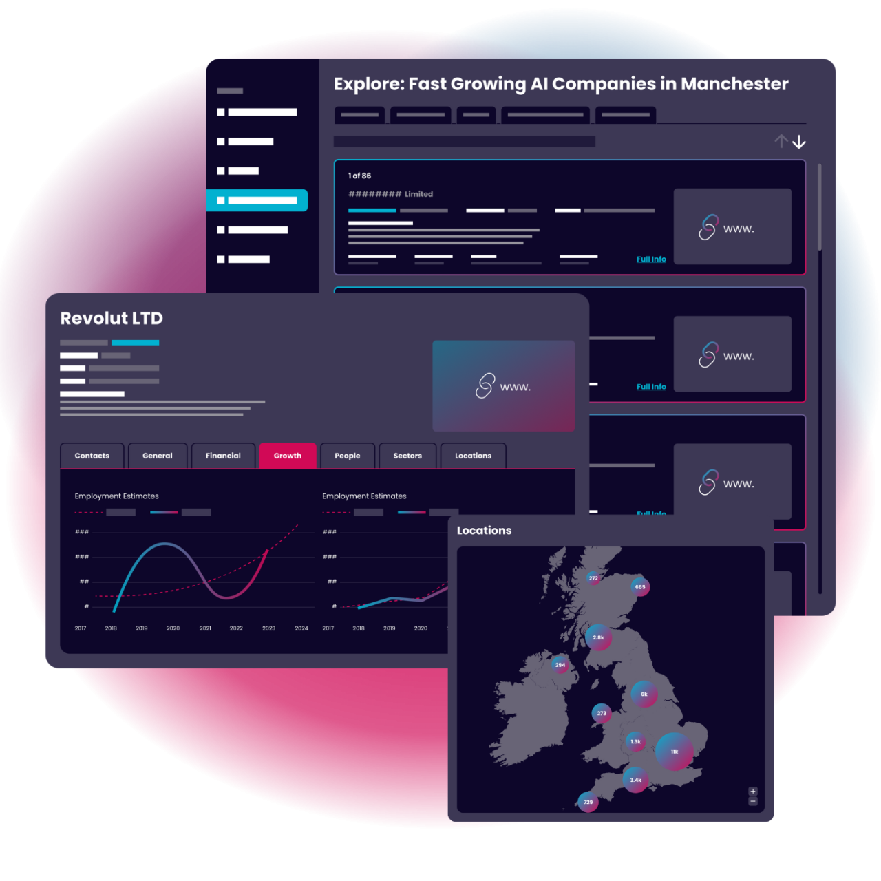
Fed up with outdated and unreliable data? Get to know the UK economy in real-time and analyse emerging sectors and innovative companies with the power of The Data City’s AI-powered platform.
Trusted by industry-leading policy makers, economists & institutions


What is the Geospatial Economy?
The Geospatial industry or economy consists of a range of companies, start-ups and organisations who work with technology or provide services to capture, process, analyse, visualise or store geographic data across the UK.
Geospatial companies in the UK range from those developing proprietary Geographic Information Systems (GIS) and indoor mapping solutions right the way through to those specialising in 3d visualisation and data processing.
Geospatial Economy sector summary
Discover real-time data and insights sourced directly from The Data City platform, driven by our innovative Real-Time Industrial Classifications (RTICs). Our RTICs harness the power of web data and machine learning, and are published with industry experts for precision and relevance.
Here are the key facts about the Geospatial Economy sector. The sector has a turnover of £5.0bn currently, has received £383.6m of investment and the sector is growing at 1.9% per year.
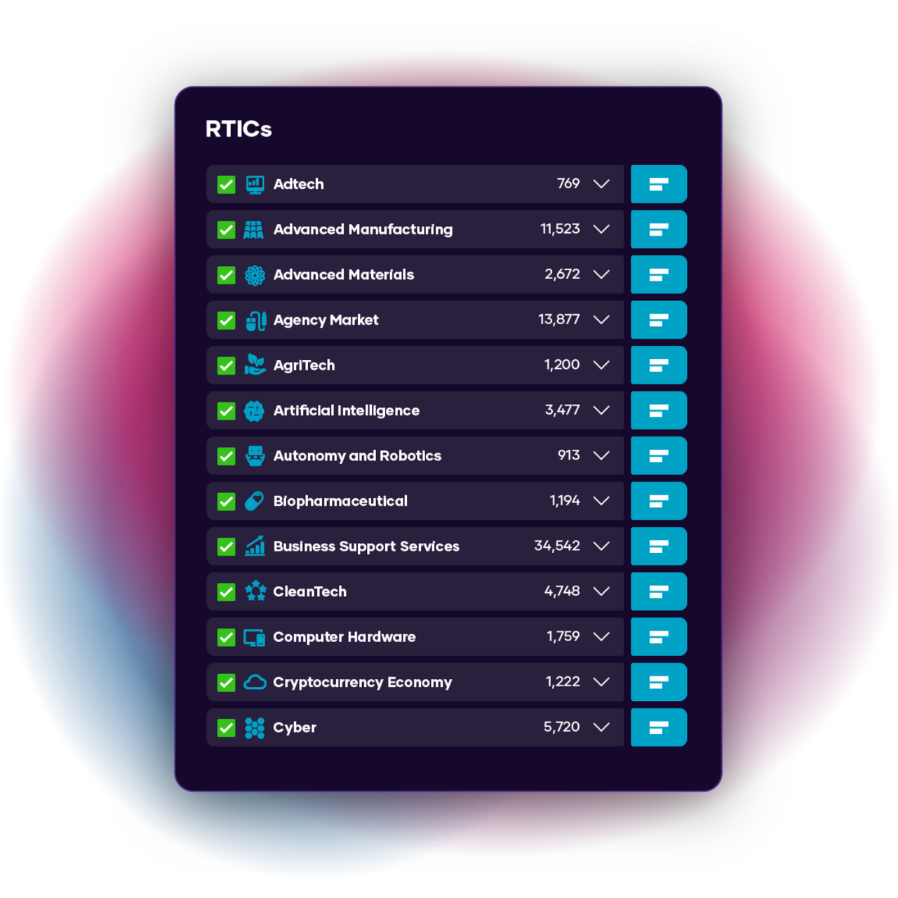
Geospatial Economy verticals
Our industry data goes deep. See the top verticals and specialisms making waves in the UK Geospatial Economy industry today.
Our Geospatial Economy RTIC is made up of 4 individual verticals. The top verticals in this sector include Data Capture, and Data Processing and Visualisation. You can find out more about the verticals by downloading our RTIC report, or by signing up for a free trial of The Data City platform.
- Sector Code Description Records
-
RTIC0008 Geospatial Economy 2409 companies
Companies working with geographical data in some form, including but not limited to; Data Capture, Data Processing and Visualisation, Geospatial and GIS Technologies, Navigation Technologies.
-
Geospatial Economy: Data Capture1479 companies
Companies focused on the production of geospatial datasets
-
Geospatial Economy: Data Processing and Visualisation1440 companies
Companies offering geolocation data processing and visualisation services
-
Geospatial Economy: Geospatial and GIS Technologies441 companies
Companies providing Geographic Information System products
-
Geospatial Economy: Navigation Technologies361 companies
Companies providing technologies and/or services that enable the collection, processing and analysis of navigation data
-
We help policy makers, economists & companies better understand emerging industries
The Data City is a UK-based data provider and SaaS platform focusing on emerging sectors, high growth companies, innovation clusters and investment.
Many of the UK’s leading government departments, local authorities, investment firms and policymakers, use The Data City to gain real-time insights that help drive better investment decisions.
“ If you want a more dynamic and innovative view of your economy, you should definitely consider The Data City

“ Through this visual mapping project, Greater Manchester will be able to showcase our success in the digital sector
“ If you care about technology driven economic growth, you should care about RTICs
Get your free Geospatial Economy market report 👇
Dig deeper into the UK’s Geospatial Economy industry with our free snapshot report.
Includes key insights on market size, investment, growth, location and much more. Data updated every month.
Market data for 400+ industries at your fingertips
At The Data City we use AI and real-time data to map emerging sectors and innovative companies.
Our company database of over 5 million active UK companies houses 400+ Real-Time Industrial Classifications (RTICs) built in partnership with leading experts.
Access market insights, sector trends, employee data, growth stats and investment information for the country’s fastest growing industries.
Discover more with a Free Trial
Keen to dig a little deeper? Sign up for a free trial and get full access our real-time company and sector data.